Integrated travel map unveiled at Bishopstone railway station


The illustrated map on the platform at the railway station shows travellers a range of nearby leisure pursuits from walking, cycling and horse-riding to swimming, sailing and sunbathing.
It also highlights rail and bus connections to and from the station on the Seaford to Brighton line in East Sussex.
Advertisement
Hide AdAdvertisement
Hide AdAllison Thorpe, strategy lead for access and recreation at the South Downs National Park Authority, commented: “Stations like Bishopstone are gateways to the South Downs National Park. That is why we were so pleased to work with the Friends of Bishopstone Station and the Community Rail Partnership to give people ideas for walks to the countryside and historic villages in the Downs and to show people how easy it is to explore the National Park by rail.”
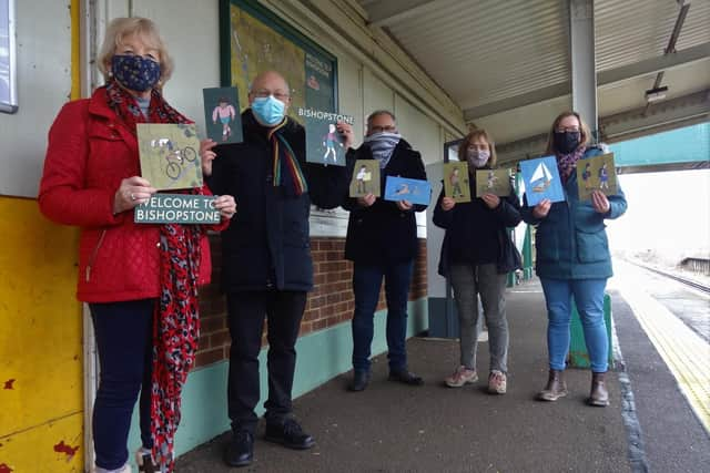
The map is a joint project from the South Downs National Park, Community Rail Network, Southeast Communities Rail Partnership and the Friends of Bishopstone Station with support from Southern Railway.
They commissioned Eastbourne-based publisher Robert McGowan (Riffle & Pool Press) to produce the map. He worked with illustrator Benjamin Phillips and graphic designer Sarah Macbeth, who are both based in St Leonards.
Speaking at the launch of the map, Robert said: “This project was a lot of fun to work on. I think the illustrated map gives an impression of what the landscape actually feels like – how the station is connected to the beach, the old village and the Downs.”
Advertisement
Hide AdAdvertisement
Hide AdBarbara Mine, chair of the Friends of Bishopstone Station, added: “We are so pleased to have received this integrated travel map. It puts people in the picture as to where they are and where they want to go to.”
Jools Townsend, chief executive of Community Rail Network, said: “What a fantastic example of true partnership work, something Community Rail groups really do excel at. Connecting railways to their communities and the beautiful countryside which surrounds so many lines is so important to the future. I look forward to seeing the map.”
Southeast Communities Rail Partnership lines manager Catherine Simmons said: “The map is a very good example of collaboration between the designers and community groups working together to create a beautiful map.”
READ MORE: